Back to Books
G:N2:7
4
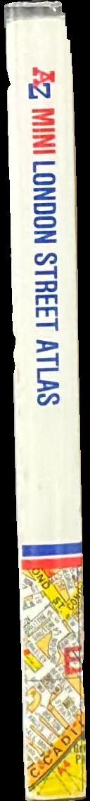
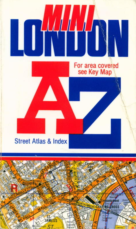
A-Z mini London street atlas and index
Edit position
Edit position
Last set 12 hours, 14 minutes ago. Manual moves override automatic placement until the next shelfie/spine match.
Loading shelves…
A-Z mini London street atlas and index
by Geographers' A-Z Map Co.
No description yet.
Accession
11315
ISBN
085039256X
Publisher
Geographers' A-Z Map Co.
Book Images
Reference and live side by side Hover to see live images
Reference
Live
No live
No live
CONNECTIONS
No connections
State
- on_shelf
- True
- position_updated_at
- 2026-06-12 13:54
- orientation
- vertical
- position_confidence
- 1.00
Details
Physical
- binding_type
- Hard Back
- dimensions
- none captured
- spine_text
- none captured
Metadata
- Book form
LOCATION HISTORY
Book Location
Updated 12 hours, 14 minutes agoBook Images
Reference and live side by side Hover to see live images
Reference
Live
No live
No live
Vernon snapshot
View liveFrozen copy of Vernon's record from the last sync. Fields tagged → flow back into the Pulse record.
Last synced 2026-06-12 12:55 (13 hours, 13 minutes ago)
Identity
Drives Pulse state
Descriptive
Subjects & people
Cover image
Raw Vernon JSON
click to inspect
The source payload behind the snapshot above.
Raw Vernon JSON
click to inspectThe source payload behind the snapshot above.
Use ⌘F to search once expanded.
"slug": "a-z-mini-london-street-atlas-and-index"
"opacObjectId": "15094"
"opacCollection":
"opacCollectionId": "1"
"imagesCollection":
"images":
"[0]":
"imageId": "49466"
"cssColors":
"[0]":
"hex": "191970"
"hue": 240
"rank": 1
"presence": 22.04
"colorName": "midnightblue"
"lightness": 27
"colorGroup": "blue"
"saturation": 64
"formattedColorName": "midnight blue"
"[1]":
"hex": "dc143c"
"hue": 348
"rank": 2
"presence": 14.79
"colorName": "crimson"
"lightness": 47
"colorGroup": "red"
"saturation": 83
"formattedColorName": "crimson"
"[2]":
"hex": "f5f5dc"
"hue": 60
"rank": 3
"presence": 43.66
"colorName": "beige"
"lightness": 91
"colorGroup": "white"
"saturation": 56
"formattedColorName": "beige"
"[3]":
"hex": "cd853f"
"hue": 30
"rank": 4
"presence": 10.87
"colorName": "peru"
"lightness": 53
"colorGroup": "brown"
"saturation": 59
"formattedColorName": "peru"
"[4]":
"hex": "a9a9a9"
"hue": 0
"rank": 5
"presence": 6.68
"colorName": "darkgray"
"lightness": 66
"colorGroup": "gray"
"saturation": 0
"formattedColorName": "dark gray"
"rawColors":
"[0]":
"hex": "172f86"
"hue": 227
"rank": 1
"presence": 22.04
"lightness": 30
"saturation": 70
"[1]":
"hex": "e41d20"
"hue": 359
"rank": 2
"presence": 14.79
"lightness": 50
"saturation": 78
"[2]":
"hex": "f3f0e5"
"hue": 47
"rank": 3
"presence": 43.66
"lightness": 92
"saturation": 36
"[3]":
"hex": "be8c35"
"hue": 38
"rank": 4
"presence": 10.87
"lightness": 47
"saturation": 56
"[4]":
"hex": "a49397"
"hue": 345
"rank": 5
"presence": 6.68
"lightness": 60
"saturation": 8
"[5]":
"hex": "a3b0c2"
"hue": 214
"rank": 6
"presence": 1.95
"lightness": 70
"saturation": 20
"[6]":
"hex": "6796b7"
"hue": 204
"rank": 7
"presence": 0.01
"lightness": 56
"saturation": 35
"imageLabels":
"[0]":
"count": 19169
"score": 52.4
"status": "auto_verified"
"imageLabel": "Publication"
"imageLabelId": 23
"imageDerivatives":
"[0]":
"url": "https://browser.mona.net.au/records/images/large/31512/4b66a112326f58b6a84a66079d3d4c8d7202ee55.jpg"
"width": "474"
"height": "800"
"identifier": "LARGE"
"[1]":
"url": "https://browser.mona.net.au/records/images/medium/31512/4b66a112326f58b6a84a66079d3d4c8d7202ee55.jpg"
"width": "237"
"height": "400"
"identifier": "MEDIUM"
"[2]":
"url": "https://browser.mona.net.au/records/images/nano/31512/4b66a112326f58b6a84a66079d3d4c8d7202ee55.jpg"
"width": "21"
"height": "35"
"identifier": "NANO"
"[3]":
"url": "https://browser.mona.net.au/records/images/small/31512/4b66a112326f58b6a84a66079d3d4c8d7202ee55.jpg"
"width": "89"
"height": "150"
"identifier": "SMALL"
"[4]":
"url": "https://browser.mona.net.au/records/images/tiny/31512/4b66a112326f58b6a84a66079d3d4c8d7202ee55.jpg"
"width": "44"
"height": "75"
"identifier": "TINY"
"[5]":
"url": "https://browser.mona.net.au/records/images/xlarge/31512/4b66a112326f58b6a84a66079d3d4c8d7202ee55.jpg"
"width": "710"
"height": "1200"
"identifier": "XLARGE"
"totalImages": 1
"objectSearchScore": 0.30564046
"opacObjectFieldSets":
"[0]":
"identifier": "accession_no"
"opacObjectFields":
"[0]":
"value": "11315"
"[1]":
"identifier": "name"
"opacObjectFields":
"[0]":
"value": "A-Z mini London street atlas and index"
"opacObjectFieldAttributes":
"[0]":
"key": "title"
"value": "A-Z mini London street atlas and index"
"[2]":
"identifier": "other_name"
"opacObjectFields":
"[0]":
"value": ""
"[3]":
"identifier": "artist_last_first"
"opacObjectFields":
"[0]":
"value": "Geographers' A-Z Map Co."
"[4]":
"identifier": "prod_pri_date"
"opacObjectFields":
"[0]":
"value": "1991"
"opacObjectFieldAttributes":
"[0]":
"key": "earliest_date"
"value": "1991-01-01Z"
"[1]":
"key": "latest_date"
"value": "1991-12-31Z"
"[5]":
"identifier": "prod_pri_date_notes"
"opacObjectFields":
"[0]":
"value": ""
"[6]":
"identifier": "edition"
"opacObjectFields":
"[0]":
"value": ""
"[7]":
"identifier": "brief_desc"
"opacObjectFields":
"[0]":
"value": "This brief record was created for storage and loan purposes only."
"[8]":
"identifier": "measure_desc"
"opacObjectFields":
"[0]":
"value": ""
"[9]":
"identifier": "credit_line"
"opacObjectFields":
"[0]":
"value": ""
"[10]":
"identifier": "curr_loc_status"
"opacObjectFields":
"[0]":
"value": "On Shelf"
"opacObjectFieldAttributes":
"[0]":
"key": "search"
"value": "curr_loc_status:"On Shelf""
"[11]":
"identifier": "ob_status"
"opacObjectFields":
"[0]":
"value": "Accessioned"
"[12]":
"identifier": "lender"
"opacObjectFields":
"[0]":
"value": ""
"[13]":
"identifier": "copyright_owner"
"opacObjectFields":
"[0]":
"value": ""
"[14]":
"identifier": "copyright_type"
"opacObjectFields":
"[0]":
"value": ""
"[15]":
"identifier": "copyright_start"
"opacObjectFields":
"[16]":
"identifier": "copyright_expiry"
"opacObjectFields":
"[17]":
"identifier": "copyright_notes"
"opacObjectFields":
"[0]":
"value": ""
"[18]":
"identifier": "curr_loc"
"opacObjectFields":
"[0]":
"value": "Zone N2/Level 1/Phrontisterion/MONA"
"[19]":
"identifier": "object_type"
"opacObjectFields":
"[0]":
"value": "Books/Document genres/Information forms/Visual and Verbal Communication"
"opacObjectFieldAttributes":
"[0]":
"key": "search"
"value": "object_type:"Books/Document genres/Information forms/Visual and Verbal Communication""
"[20]":
"identifier": "collection"
"opacObjectFields":
"[0]":
"value": "Main Collection/Library"
"opacObjectFieldAttributes":
"[0]":
"key": "search"
"value": "collection:"Main Collection/Library""
"[21]":
"identifier": "prod_pri_place"
"opacObjectFields":
"[0]":
"value": "Sevenoaks/Kent/England"
"[22]":
"identifier": "prod_pri_publisher"
"opacObjectFields":
"[0]":
"value": "Geographers' A-Z Map Co."
"[23]":
"identifier": "physical_notes"
"opacObjectFields":
"[0]":
"value": "192 pgs"
"[24]":
"identifier": "language"
"opacObjectFields":
"[0]":
"value": "English"
"[25]":
"identifier": "isbn_issn"
"opacObjectFields":
"[0]":
"value": "085039256X"
"[26]":
"identifier": "user_sym_1"
"opacObjectFields":
"[0]":
"value": "914.212 LON"
"[27]":
"identifier": "usual_loc_being"
"opacObjectFields":
"[0]":
"value": "Zone N2/Level 1/Phrontisterion/MONA"
"[28]":
"identifier": "subject_class"
"opacObjectFields":
"[0]":
"value": "Maps/Cartographic materials/Non-book materials/Library materials"
"opacObjectFieldAttributes":
"[0]":
"key": "search"
"value": "subject_class:"Maps/Cartographic materials/Non-book materials/Library materials""
"[1]":
"value": "Reference works/Informational works"
"opacObjectFieldAttributes":
"[0]":
"key": "search"
"value": "subject_class:"Reference works/Informational works""
"[2]":
"value": "Road maps/Maps/Cartographic materials/Non-book materials/Library materials"
"opacObjectFieldAttributes":
"[0]":
"key": "search"
"value": "subject_class:"Road maps/Maps/Cartographic materials/Non-book materials/Library materials""
"[29]":
"identifier": "subject_date"
"opacObjectFields":
"[30]":
"identifier": "subject_event"
"opacObjectFields":
"[0]":
"value": ""
"[31]":
"identifier": "subject_period"
"opacObjectFields":
"[0]":
"value": ""
"[32]":
"identifier": "subject_object"
"opacObjectFields":
"[0]":
"value": ""
"[33]":
"identifier": "subject_person"
"opacObjectFields":
"[0]":
"value": ""
"[34]":
"identifier": "subject_place"
"opacObjectFields":
"[0]":
"value": "London/England"
"opacObjectFieldAttributes":
"[0]":
"key": "search"
"value": "subject_place:"London/England""
"[35]":
"identifier": "assoc_person"
"opacObjectFields":
"[0]":
"value": ""
"[36]":
"identifier": "assoc_place"
"opacObjectFields":
"[0]":
"value": ""
"[37]":
"identifier": "assoc_event"
"opacObjectFields":
"[0]":
"value": ""
"[38]":
"identifier": "assoc_object"
"opacObjectFields":
"[0]":
"value": ""
"[39]":
"identifier": "user_sym_9"
"opacObjectFields":
"[0]":
"value": ""
"relationshipsCollection":
"relationships":
"[0]":
"relatedRecords":
"[0]":
"slug": "geographers-a-z-map-co"
"title": "Geographers' A-Z Map Co."
"relatedRecordId": "15179"
"relationshipId": "object_prod_pri_person"
"relatedRecordType": "person"
"totalRelatedRecords": 1
"totalRelationships": 1